Lake George

Lake George
Lake George - from Tongue Mtn Range - 11/11/2011

Thursday, May 29, 2014

Cascade Mountain from Cascade Falls - 5/29/14

 
 Sandwiched between Upper and Lower Cascade Lake a the pretty little Cascade Lakes Day Use Picnic Area.  The entrance is tough to get into as you're heading west.  The entrance is on about a 150 degree angle and it goes downhill.  It's best to go to the Cascade Mountain trailhead, turn around and then pull into the picnic area as you are heading east. 

The picnic area is the site of the old Cascade House Hotel that existed from the late 1870's until the 1930's.  Behind the picnic area (to the southeast) lies a beautiful waterfall (Cascade Falls) and a slide (called the #7 slide since it is shaped like the #7 .  This slide was opened up by Hurricane Irene in August 2011.  The falls is known to be a great ice climbing in the winter.

There is an unmarked herd path that starts at the back of the picnic area that leads to the base of the falls in .3 miles.  I went in after work today to get some pictures of the falls and thought I would continue to the top of Cascade Mountain if the bushwhack wasn't too difficult.  I started out at 5:10 PM.
 
 
Cascade Falls in the background
 
It's an easy walk to the base.  I took some pictures there, then rather than scale the steep slide at the falls, I ducked into the woods on the left hand side a followed a faint herd path ascending the woods adjacent to the slide. 
 

Getting closer
 

On the base of the slide, heading for the base of the falls 
 
 
Alongside the falls
 
 
After getting up alongside the falls, I began to drift away as I climbed since the walking near the falls was getting increasingly rugged.  Once I reached an approximate elevation of 2800', I came across a herd path leading back to the falls.  At this elevation, I was above the falls and came out onto the #7 slide just above the falls.
 

Climbing the # 7 slide
 
The slide was not so steep at this point and I began climbing in the slide.  Soon I came to a fork and took the left branch which had more clean rock.   A couple pictures below show various points on the slide.


 I followed the slide up until the final headwall at which point I went into the woods on the right to skirt the headwall.

The final headwall can be seen at the end


Bypassing the headwall


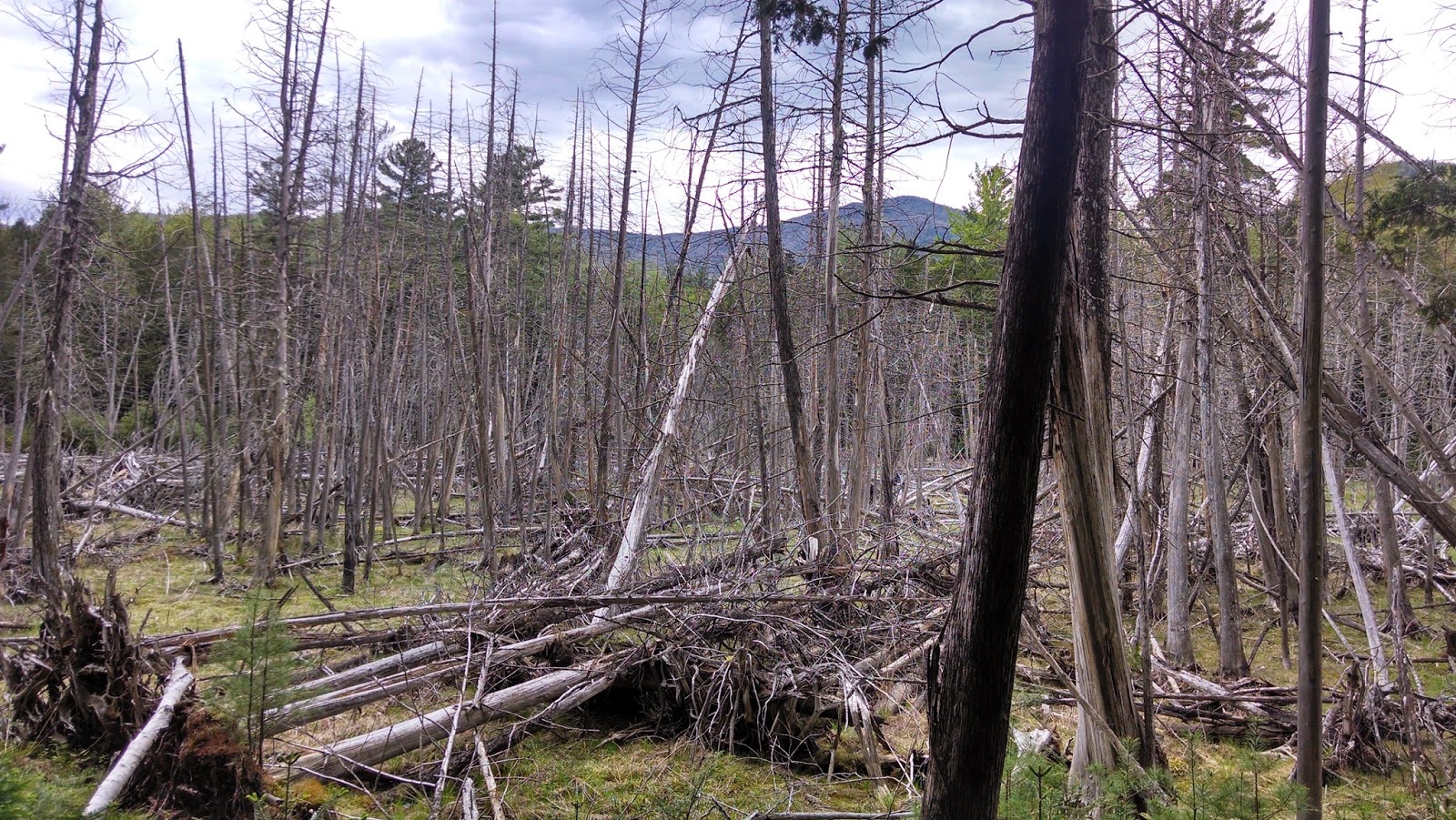
Above the headwall, the bushwhacking was pleasant.  The woods were relatively open conifers and birches.  At about 3500' , I began to once again see various traces of herd paths.  They weren't needed.  The walking was easy.
 

Open woods above the slide


Approaching the summit of Cascade Mountain
 
At 6:30 I reached the summit.  It had taken 1 hour and 20 minutes to go 1.2 miles, but I had climbed 2000 vertical feet in that distance.  I spent about 10 minutes on the summit.  Nobody was there!  (See pictures below of the summit looking different directions). 


After my summit photos on Cascade, I decided to high tail it over to Porter.  I trail ran the .7 miles in about 15 minutes.
 

The summit of Porter Mountain
 
I didn't linger on Porter, since it was now 6:45.  I turned around and went  back to the Cascade/Porter trail junction.  It was now 7 PM.  I decided to trail run down the trail rather than bushwhack my way back down.        
 

Zoom of Cascade from Porter
 
The trail was its' usual rocky, muddy, rooty self, but I got to the bottom in 30 minutes.  It was now 7:30 and I had the short walk on the road in the pass along Upper Cascade Lake to get back to the car.  That took 15 minutes, and I was on my way home at 7:45.
 
I must admit that I am enjoying the bushwhacks more than the trail hikes; especially in the high peaks, where the trails get so much use that they are somewhat of a mess.
 
 
This was a fine trip to the top and the first time I haven't used the trail to get there.
 
Hike Stats:
Hike Distance:  4.7 miles
Hike Time:  2.5 hours
Total Vertical Gain:  ~2250' 


The route (the bushwhack portion was from the lakes to the summit of Cascade)
(Click image to enlarge)

Monday, May 26, 2014

Platt Brook - Hoffman Notch Wilderness - 5/26/14

 
 I had a couple hours today (Memorial Day) to get out for a walk with the dog.  I decided to go back to the Dirgylot Hill parking lot on Route 9 in Schroon Lake to continue the exploration I started on Saturday.

This time I wanted to look at the area where a future lean-to is planned.  The Hoffman Notch Wilderness Unit Management Plan shows a future lean-to at the confluence of Platt Brook and two other un-named drainages.

From the parking lot, I followed the primary jeep road for 1.1 miles to the first pair of spring houses that I had seen on  Saturday.  At that point, there was another old jeep road branching off to the right heading due west.

I followed this trail up over a small ridge line to the north of Smith Hill.   The trail then turned SW and wrapped around Smith Hill dropping down to a wet marshy area.


Marsh NW of Smith Hill


I continued SW towards my target location following a faint heard path along the edge of the marsh and the base of Smith Hill.  As I neared the water sources, I came upon a well defined unmarked foot path.


Platt Brook
 
I first followed the foot path to the SE until it appeared to fade away near another wet marshy area.  Below are just some pictures along the way of the brook.
 

Rev found Platt Brook to be acceptable 


Next I retraced my steps on the footpath to where I first found the path and then continued to follow it in  the other direction (NE).  There were several small herd paths, but the most obvious path continued along Platt Brook.  There were several nice water spots along the way.


This whole area just provides a great place to walk.  Platt Brook is very pretty and very accessible.  The future North Country Scenic Trail is proposed to go through this area and I can see why.
 
This is an area very few people visit, or have heard of, but it is a pleasure to explore.


The obvious foot trail
 
 
Foot path continuing along Platt Brook
 

Water sheets on Platt Brook
 
Hike Stats:
Hike Distance:  6 miles
Hike Time:  2.5 hours
Total Vertical Gain:  ~ 900'

 
The route (Click image to enlarge)

Dial and Nippletop from Round Pond via Gravestone Brook - 5/25/14

This was a repeat of a trip I did in July of 2013 with my dog Rev.  This time my wife Leesa wanted to go this route so she could hike Dial and Nippletop; two peaks she had not climbed.  These would be #'s 38 and 39 for her.  Since Rev was going with us we used Gravestone Brook to get from the Dix Trail to Dial.

It was a nice morning; sunny and about 50 degrees.  An afternoon thunder storm was possible, but we never saw any rain.  We arrived at the Round Pond trailhead just after 7:30 and claimed the last parking spot in the lot.  In minutes we arrived at Round Pond.  There was a tent at the first campsite on the right.  Three canoes were out on the pond with men fishing.
  

Round Pond in the morning sunlight

It was a peaceful morning at the pond.  I'm sure the men were enjoying the fishing.  We continued on and reached the height of land at 1.6 miles after 45 minutes from the car.  Next we dropped down along the Boquet River and followed it towards the Boquet lean-to.  

Round Pond


This was the first time on the Dix Trail for Leesa in spring.  Her only previous trip on this trail was in winter so everything looked different from when she last was here.  


A beautiful oxbow along the Boquet 

At the 3.5 mile mark we reached Gravestone Brook and it was time to do a little bushwhacking.  From my previous trip, I recalled that the right side of the brook was easier terrain to navigate and we chose that way again.  There is a slight herd path (animal path) that we followed along the way.  The biggest impediment was a lot of Witch-Hobble which would trip us up occasionally.


Witch-Hobble 
We enjoyed the cascades of Gravestone Brook.  There are numerous 4' drops and lots of areas where water slides down sheets of rock.  We weren't always at the waters edge.  At times, the walking was a little easier a short distance away from the brook.

Near the top of the brook, it splits in a Y.  We took the right hand fork to avoid bushwhacking up the steeper left fork.  Shortly the brook ended and soon we popped out on the trail near the Dial/Bear Den col, just slightly on the Dial side.  The elevation at this point was 3200'.
  

Gravestone Brook

The trail felt easy after the bushwhack, and we quickly climbed the 800' to the summit of Dial.  Number 38 for Leesa.  There was one lone gentleman enjoying the view of the Great Range from the summit rock.  We still had blue skies and some nice puffy cumulus clouds.  Rain was nowhere in sight.   

We stopped and had some left over pizza here.  I had brought a few drinks (some frozen) and the frozen ones weren't thawing as fast as I thought they might.  I fact, they were still half frozen when we got back to the car.


The Great Range!


Great Range, take two.

Leesa and Rev
As we made our way up the pointless ups-and-downs (PUDs), we soon began to see a few hikers and had a couple nice chats along the way.   We reached the summit and shared it with four other folks before they all left and we had a little time to ourselves at the top.  I didn't expect that on Memorial Day weekend.  High peak number 39 for Leesa! 

On the way down we saw one man with a dog near the sign for Elk Pass.  I didn't think to ask him which way he came up with his dog. 


I love this view of Dix from Nippletop

We had an uneventful descent.  The bushwhack seemed longer on the return, even though it was downhill. 

Elk Lake in the distance (from Nippletop)


A couple more clouds, but still nice


Dix


A PUD on the way back to Dial


This was the only patch of snow we saw.  They were also a couple small ice patches.

We stopped twice to soak our feet in the cold water on the return; once at the bottom of Gravestone Brook, and once at the Noonmark Trail junction.  It always feels good to stick hot feet in cold water!


We saw one tent pitched a mere 20 feet off the trail just a little east of the Noonmark Trail junction.  The holiday weekend crowd don't always know the rules (150' from water or trail, and no camping above 3500' unless at a designated location).

We got back to the car around 6:30 after another nice day in the woods.  Rev slept on the way back to Schroon Lake.

Hike Stats:
Hike Distance:  15 miles
Hike Time:  10 hours + stoppage time
Total Vertical Gain:  ~ 4000'
    

The route (click image to enlarge)