
Heading out on a nice early Fall day, Leesa, Rev and I headed North towards the Tupper Lake, not sure where we'd end up. Sometimes it's nice that way; no set plans, just a general direction and ideas. We ending up choosing a 5 mile roundtrip hike to Winding Falls (also called Pa's Falls), on the Bog River, from the North, starting from Route 421.
This trail appears to be fairly new; perhaps created within the last few years. The trail does not appear on the National Geographic Map 745 (Old Forge/Oswegatchie). There is a trailhead sign on Route 421. A gate is visible from the road. Parking is simply on the shoulder of the road. We chose this hike because the distance was right, and the desire to see a waterfall that we hadn't seen before. Reseaching after the fact I see that the trail does appear on the All Trails app and is listed as a 5.5 mile hike with 616' vertical.
We weren't sure how impressive the falls would be, but that is half the fun. The name Winding Falls sounded interesting to us, so off we went.
 |
| Beaver dam pond at 0.6 miles |
No bugs this time of year and the trail was mostly dry. The leaves are starting to turn and there was some color to observe on the trail and while driving around the area.
When we reached the Bog River we came to an old steel beam bridge that hasn't seen traffic in many years.
 |
| Old bridge over the Bog River, just upstream from the falls |
This falls is also accessible via a trail from the East that is sligthly longer. Note the picture of the sign before at the trail junction near the falls.
 |
| The trailhead sign and this sign near the falls are new |
When we got to the falls we were quite impressed. There really three seperate significant drops, as seen in the pictures below.

 |
| Marker near the falls |

The water really roars through the area. It must be something to see in the spring.
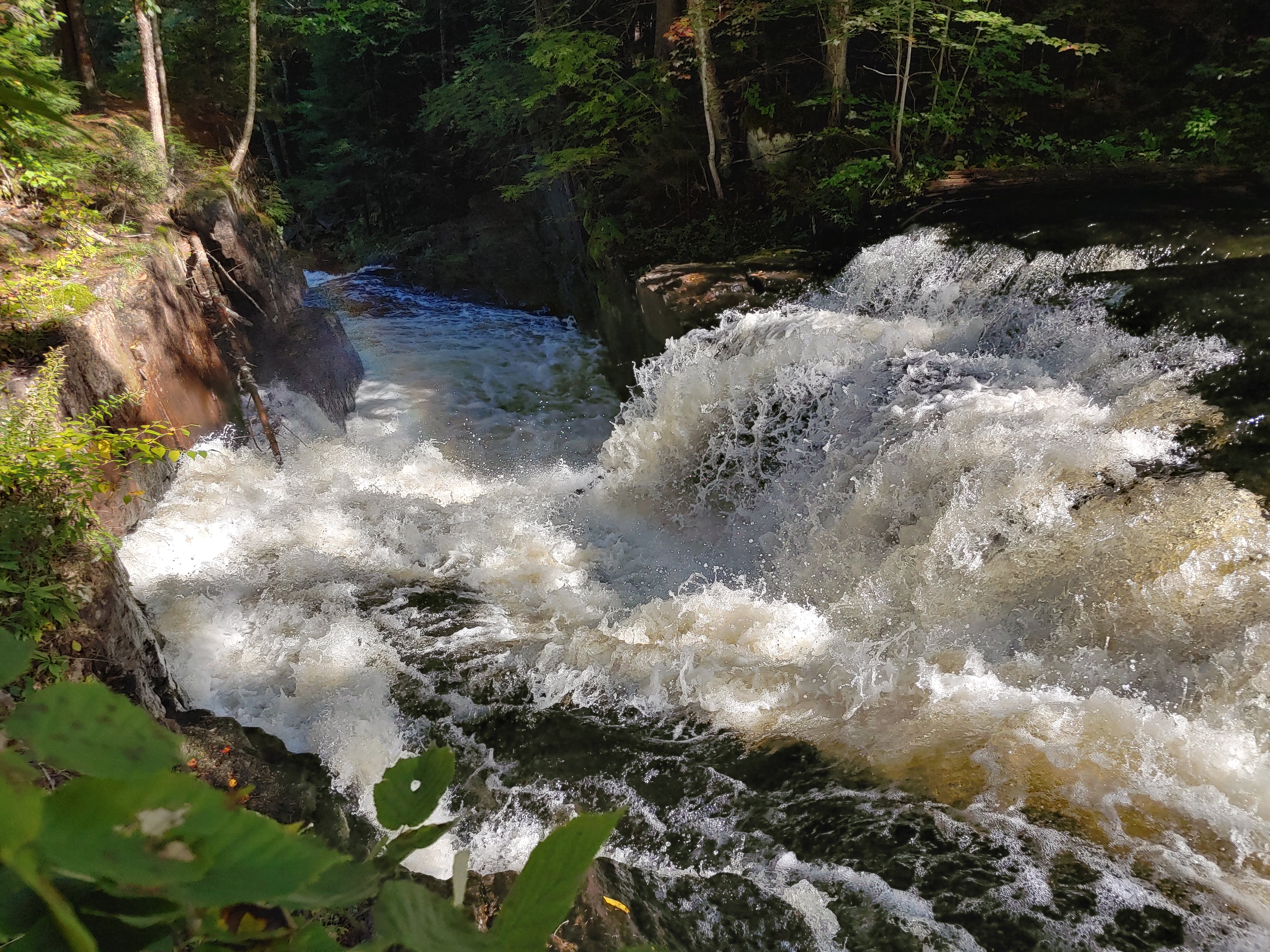 |
| Yes, it is winding |
The falls exceeded our expectations, making this hike defintely worthwhile in our minds.
 |
| No swimming here.. |
 |
| Perhaps you could swim below this last portion of the falls |
It took us an hour each way at a moderate pace. We lingering at the falls for awhile since it was so nice.
 |
| Rev is hiding... |
We had brought our tent and camping gear in case we decided to spend the night up north. After returning to the car we headed south towards Indian Lake. We arrived at the Lewey Lake State Campground on the SW corner of the lake and found, or our surprise, that one of the prime lakeside sites was empty. We inquired at the campground office and the attendant said "yep they left a day early". Perhaps they hadn't been prepared for nighttime temps of about 40 degrees, but it was our good fortune. We snagged the site and had a lovely evening campfire lakeside. We awoke to the predawn glow pictured below. All in all a nice trip!
 |
| Pre-sunise at Indian Lake |
 |
| The route |
Hike Stats:
Hike Distance: 5.5 miles
Total Vertical Gain: 650'
Hike Time: 3 hours, including stops