Lake George

Lake George
Lake George - from Tongue Mtn Range - 11/11/2011
Showing posts with label Tupper Lake. Show all posts

Sunday, September 25, 2022

Winding Falls - Horseshoe Lake Wild Forest - 9/24/2022

Heading out on a nice early Fall day, Leesa, Rev and I headed North towards the Tupper Lake, not sure where we'd end up.  Sometimes it's nice that way; no set plans, just a general direction and ideas.  We ending up choosing a 5 mile roundtrip hike to Winding Falls (also called Pa's Falls), on the Bog River, from the North, starting from Route 421.

This trail appears to be fairly new; perhaps created within the last few years.  The trail does not appear on the National Geographic Map 745 (Old Forge/Oswegatchie).  There is a trailhead sign on Route 421.  A gate is visible from the road.  Parking is simply on the shoulder of the road.  We chose this hike because the distance was right, and the desire to see a waterfall that we hadn't seen before.  Reseaching  after the fact I see that the trail does appear on the All Trails app and is listed as a 5.5 mile hike with 616' vertical.

We weren't sure how impressive the falls would be, but that is half the fun.  The name Winding Falls sounded interesting to us, so off we went. 


Beaver dam pond at 0.6 miles 


No bugs this time of year and the trail was mostly dry.  The leaves are starting to turn and there was some color to observe on the trail and while driving around the area.

When we reached the Bog River we came to an old steel beam bridge that hasn't seen traffic in many years.  

Old bridge over the Bog River, just upstream from the falls

This falls is also accessible via a trail from the East that is sligthly longer.  Note the picture of the sign before at the trail junction near the falls.


The trailhead sign and this sign near the falls are new


When we got to the falls we were quite impressed.  There really three seperate significant drops, as seen in the pictures below. 


Marker near the falls


The water really roars through the area.  It must be something to see in the spring.
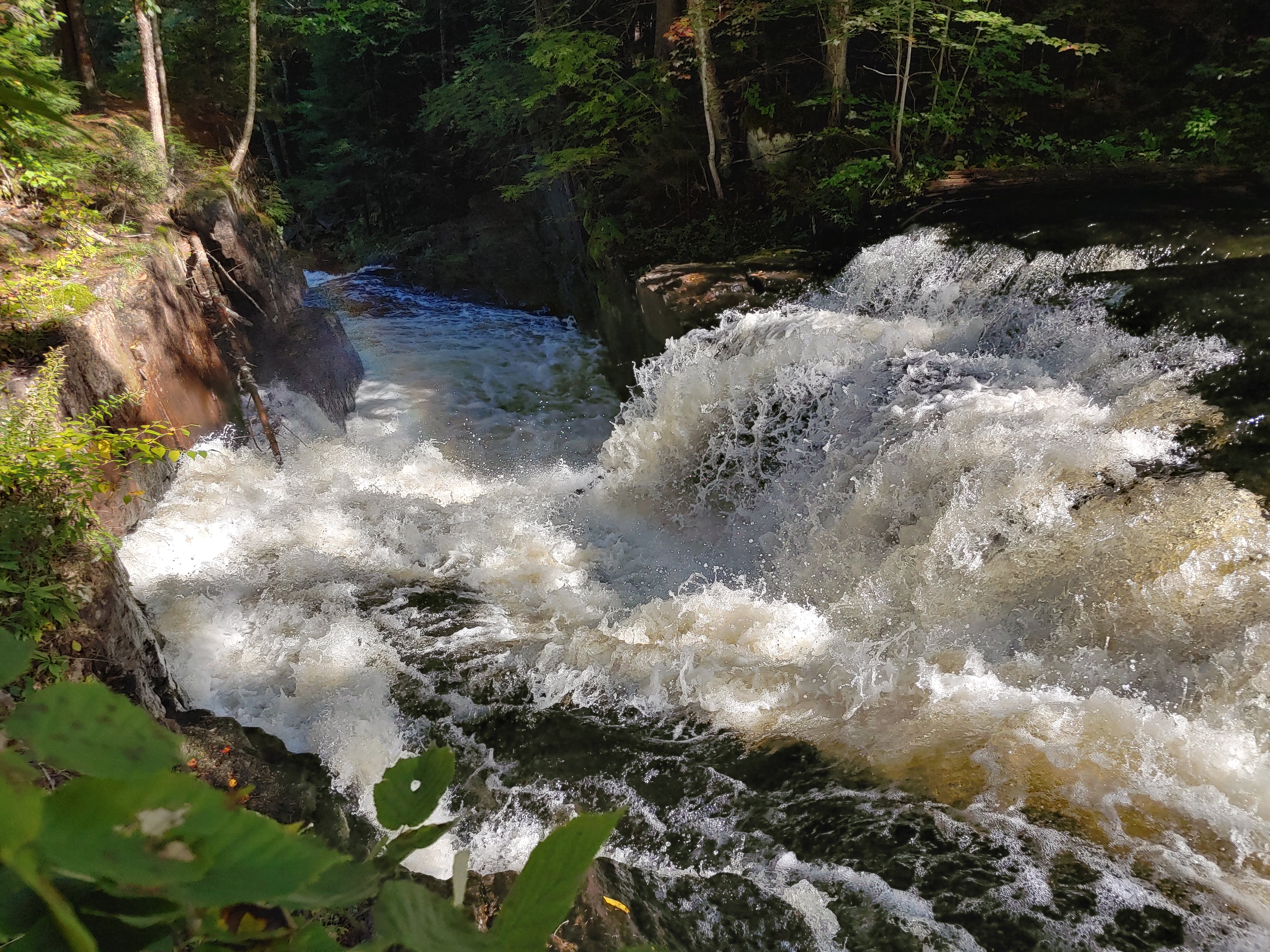

Yes, it is winding

The falls exceeded our expectations, making this hike defintely worthwhile in our minds.


No swimming here..


Perhaps you could swim below this last portion of the falls 

It took us an hour each way at a moderate pace.  We lingering at the falls for awhile since it was so nice.


Rev is hiding...

We had brought our tent and camping gear in case we decided to spend the night up north.  After returning to the car we headed south towards Indian Lake.  We arrived at the Lewey Lake State Campground on the SW corner of the lake and found, or our surprise, that one of the prime lakeside sites was empty.  We inquired at the campground office and the attendant said "yep they left a day early".  Perhaps they hadn't been prepared for nighttime temps of about 40 degrees, but it was our good fortune.  We snagged the site and had a lovely evening campfire lakeside.  We awoke to the predawn glow pictured below.   All in all a nice trip!    

Pre-sunise at Indian Lake

 
The route

Hike Stats:
Hike Distance:  5.5 miles
Total Vertical Gain:  650'
Hike Time:  3 hours, including stops 

Wednesday, December 10, 2014

XC Ski - Tupper Lake Golf Course - 12/10/14

The snowstorm that was supposed to hit the north country did not make it to the Lake George area, at least by this morning; we had nothing but rain.  Fortunately, areas north and west did get some snow. I left the house this morning with my dog Rev to go in search of a good area to cross country ski.

First I traveled to Blue Mountain Lake thinking I'd do a piece of the Northville-Placid Trail. Unfortunately, when I got there, I found only about 6 inches of snow and that was not enough to had out into the woods.  I drove north to Long Lake and found the same problem.  I continued north to Tupper Lake and still there was only 7" on the ground.  Apparently the 12-18" forecast for Hamilton County was wrong.

Since skiing in the woods wasn't going to work out, I called my son and planned to meet him for lunch in Tupper Lake.  He suggested I try skiing over at the Tupper Lake Golf Course before lunch, so I headed over there to check it out.   

When I arrived, only 1 car was there.  A woman and her dog were just getting back to her car after a doing a ski loop.  It turns out she is a Kindergarten teacher and schools were closed today so she had a chance to get out in the snow with her dog.  My dog Rev played with her dog for 5 minutes while we talked and then we hit the trails.

The Golf Course provides lots of open terrain, but their are also jeep trails on the property that go through the woods.  When I arrived, a person affiliated with the golf course had just gone around all the trails with a snowmobile to provide a skiable track.    


Information at one of the trail junctions 

It was a little windy out in the open, so I followed the snowmobile track off into the woods.  This ended up taking me to Cranberry Pond (called Tupper Lake Reservoir on the topo map).   As I got partway around, I saw the trail map indicating where I was and where the trail loops go. 

   
Here is a good map showing the trail loop options

There was about 7 inches of snow on the ground and it was enough for the golf course and the jeep roads.  The snow was a little moist so my glide wasn't very fast but that was OK.  I had my backcountry skis with me anyway, so speed wasn't going to happen.  At one point I most have gone through an area that was a little too wet and snow got stuck to the bottom of my skis.  I had forgotten to bring a scraper, so I cleaned the skis as best I could with my ski poles.  


Cranberry Pond on the right
I didn't stay too long to ski, since I now had a plan to meet my son for lunch.  Rev and I got to do one of the loops plus part of the golf course. 


This is a nice area to go for a ski; especially if snow cover is not significant.  I imagine lots of people take advantage of coming here to get a couple hours of exercise.

Below are a few pictures from the loop. 


Par of Big Tupper downhill ski area in the distance


Heading back to the car on the golf course 


After my lunch in Tupper Lake, I headed towards Lake Placid to go home.  Soon I found out where all the snow landed!  Saranac Lake and Lake Placid got hammered with over a foot of new snow.  It looked quite different than Tupper Lake with only 7".  Then as I turned south and passed through Keene, the snow depth dropped off again.  Keene had perhaps 8-10".

I had intended to ski a portion of the Jackrabbit Trail while passing though Lake Placid, but the snow was beginning to pick up again.  I decided I had better get home so I didn't have to fight my way home on snowy roads.  I had to go about 35 mph on Route 73 and 45 mph on I87 as it was.

In the end, I drove most of the day and only skied for an hour and a half.  At least I got ot have lunch with my son.  I've got tomorrow off also, so I'll try to come up with a better plan and less driving.

If you are in the Tupper Lake area, be sure to check this area out.  Access is easy.  They plow the road and parking lot very well and there is a nice choice of terrain to chose from for skiing. 

Ski Stats:
Ski Distance:  2.8 miles
Ski Time:  1 hour


The route shown on a satellite map.  You can see where the golf course is.


Topo map with the route shown

Sunday, August 31, 2014

Goodman Mountain and Coney Mountain - Horseshoe Pond Wild Forest - 8/31/14

Today's weather wasn't much to brag about (warm, muggy, rainy), but I was in Long Lake bringing a kayak to my son Zack, so we took some time to do a few short hikes in the area.
 
First up was Goodman Mountain (2162') at the southern end of Tupper Lake.  This trail was just opened this month by the Department of Environmental Conservation.  The trail boasts an accessible portion (1400' long) on an old paved road, followed by a moderate grade on the old paved road, and lastly a newly constructed foot path to complete the trek to the summit.
 
Also it was raining lightly, we saw perhaps 20 people on the trail; perhaps it was the holiday weekend, or the fact that it is a new trail.  We saw a woman with crutches on the accessible portion.  We also saw a couple that had biked the accessible portion, then hiked the rest.     
 
 
Trailhead sign on Route 30
 
The accessible portion was a quick hike for us and took perhaps 10-15 minutes.   
 

The beginning portion of the trail is an accessible trail


The newly constructed trail portion was a moderate grade.  Then were a couple slick portions that were muddy due to the rain, but we were on the top after 30 minutes from the time we left the car.


Zack and Rev on the summit of Goodman Mountain 
 
The rain stopped just before we reached the summit.  We were fortunate to have some visibility.  What surprised me was that that was no view of Tupper Lake.  It is blocked by trees on the north side of the summit.   We wandered around a little, but didn't see a viewpoint looking north.
 
Views are limited to looking mostly west and south. 


The summit of Goodman Mountain
 

Route 30 down below.
 
The rain did not return as we descended so we got back to the car mostly dry.
 

Hike Stats:
Hike Distance:  3.2 miles roundtrip
Hike Time:  1 hour, 10 minutes
Total Vertical Gain:  ~ 530'
 
 
The trail to Goodman Mountain (click image to enlarge)
 
Hike Part 2
 
Since Coney Mountain (2267')  is located just a couple miles south on Route 30 from Goodman, we headed that way to climb a 2nd small peak.  The open rock summit of Coney is visible from several locations on Route 30 on a clear day.  I had driven past it many times, but had never stopped to check it out.
 
Route 30 trailhead sign for Coney Mountain
 
 
Zack signing in at the Coney Mountain trail register


Once again, we saw several groups on the trail.  Not quite as many as on Goodman, but we still saw 3 groups.  We didn't get any more rain and we made quick work of the 1.1 mile trail to the summit.  I believe this trail has been re-routed from it's original short .5 mile trail to a longer 1.1 mile trail that now circles clockwise around to the SE side before climbing the ridge to the summit. 
 

The summit in sight
 
 Coney has a pretty awesome summit, with open rock and 360 degree views.  It would be a great place to hang out for awhile on a nice day.  Long Lake is visible to the south.


Long Lake in the distance to the south


A zoom view of Long Lake 
 

The USGS summit disc
 
 We saw hooks remaining in the rock from a weather station or previous structure that no longer exists.

The summit ridge


These hikes make for great after work hikes or chances to stretch your legs while passing through.
Coney is especially nice and I'm sure I'll do them both again in the future.
 
Hike Stats:
Hike Distance:  2.2 miles roundtrip
Hike Time:  50 minutes
Total Vertical Gain:  ~ 530'


The Coney Mountain trail (click to enlarge)