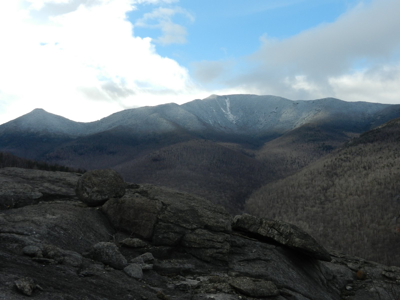
Lake George

Lake George
Lake George - from Tongue Mtn Range - 11/11/2011
Showing posts with label hiking Dix Mountain Wilderness Area. Show all posts

Sunday, January 12, 2014

Round Mountain from Round Pond - Dix Mountain Wilderness - 1/12/14

I wasn't planning on going hiking today.  The heavy rains yesterday combined with the flood watch for today had me thinking of doing other things.  I woke up however, and saw that the forecast called for partly sunny skies with a temperature in the mid 30's.  How could I not hike?  If I choose a route where there would be no water crossings, I could still have good day outdoors.
 
I decided to do a small hike to Round Mountain in the Dix Mountain Wilderness.  I would park at the Round Pond trailhead, hike the Dix trail to the height of land, then bushwhack to the summit of Round.  I expected this to be a dry route and had heard the bushwhack to Round from the south yielded light woods and lots of open rock.    
 
I was on the trail at 8:30.  The hardest part of this whole hike was the first quarter mile.  Ice flows were on the trail (this is common here), however the ice was soft, and a little slushy, so my microspikes gripped just fine.  The was 38 degrees out.  
 
 
Round Pond
 
I quickly passed Round Pond and began the 600 foot climb to the height of land.  Soon I saw 4 men coming down.  They had climbed Dix the day before (in the rain), and had stayed at the Boquet lean-to overnight.  They told me they almost got stranded, as they had a hard time finding a place to cross the Boquet on the way down, in order to get to the lean-to.  There is no way I would have wanted to climb Dix in the rain on Saturday.
 
I continued on, and reached to height of land at 1.7 miles from the trailhead.  It had been an easy 45 minute walk to this point.  My dog Rev and I turned to head north towards Round Mountain.   We had bypassed the cliffs that appear earlier on our right.  As we had heard, the bushwhacking was easy.  There was nothing but a dusting of snow on the ground.  Being off-trail now, there wasn't any ice on the forest floor beneath our feet.
 
It didn't take long to reach open rock.  There was some ice on the rock, but it was soft.  From this point on, I took my time.  I just wanted to enjoy the woods and the views.  It was still mostly cloudy, but there were some interesting skies and I stopped frequently to try and capture the moment digitally.   
   

Spotted Mountain and Grace (East Dix)
 
 
One of the early open rock areas encountered
 
As you can see in the pictures below, the cloud formations provided an ever changing light.  I snapped a lot of pictures in hopes that some would be keepers.


A panorama looking south
  
 
Another, looking SW-W
 
 
A look at Noonmark from the summit of Round Mountain
 

Spotted, Grace and Dix
  

Again with different light
  

Nippletop, Dial and Noonmark
 
There was a stiff breeze near the summit.  We took shelter behind a rock to have some refreshments.
It was still early.  It had only taken 2 hours to get to the summit, even at our leisurely pace.  Then I thought why spoil the relaxed pace.  If I headed toward Noonmark, I'd have to deal with water crossings and possibly ice up high on Noonmark.
 
 
Climbing towards Round Mountain


A little blue sky at this moment
 
 
Looking towards Giant and RPR
  

Worn signs near the summit of Round Mountain.  Noonmark in the background
  

The view south from the summit of Round


I made the decision to just go back the way we came and watch for more changing views on the way down.  It was a good plan.  I continued to snap more pictures.  I enjoyed this route.  It was a great way to have a short combo hike/bushwhack to some amazing territory and great views. 
 

Looking west on the descent
 
Hike Stats:
Hike Distance:  5.4 miles
Hike Time:  3.5 hours
Total Vertical Gain:  ~1500'


My route (click image to enlarge)


Friday, January 10, 2014

Grace & Carson (East Dix and South Dix) Mountains from Route 73 - 1/10/14

This route to Grace and Carson (East Dix & South Dix) mountains is a herd path from Route 73 at the North Boquet River.  It is known to the locals and those who do a lot of hiking.  The path is pretty well defined and in the summer it is not too hard to follow.  In the winter things get a little more difficult, but as long as you know which water course to follow, you'll be OK.

I've done this route a half dozen times in different forms.  Today I went with BillB who had the same thought as me.... we needed to get out on this Friday before the expected rain moved on in Saturday.  This route turned out to be a good plan.  We weren't sure which trails would be icy, and this herd path was in pretty good shape since it receives less traffic.

We parked the car along Route 73 and were on the trail just before 7:30.  Rev led the way, as she always does.  It was about 12 degrees when we started, but was expected to get up to 30.  Microspikes were fine along the Boquet River and up along the higher drainage.  There was only about 2" of snow down low.   


An early look at Spotted Mountain

We stayed along the south side of the Boquet River to avoid the extra water crossings on the north side.  High on the drainage, we still had a few crossings, but the volume of water is less and we didn't find it to be too difficult. 


Grace slide

As the herd path turned towards Grace slide, we found the snow depth was quickly getting deeper and at the base of the slide we put on our snowshoes.  We didn't ascend the slide itself, but rather stayed on the herd path headed for the Grace/Carson col.  The herd path is steep leading to the col, but it is a nice ascent on a good herd path.  Once it reaches the ridge, it is only a 5-10 minute walk to Grace (East Dix).

We could hear the wind picking up as we reached the ridge and the summit of Grace was quite cold with the wind chill.  We were in and out of clouds and there were a few snow flurries coming down. We took a few pictures, then followed the short herd path from the summit to the top of Grace slide.  From this vantage point, there is an unobstructed view towards Giant and Rocky Peak Ridge.  


Wyman Mountain from Grace


Mike and Rev on Grace (East Dix)


The view north from the top of Grace slide

Next we made our way towards Carson (South Dix).  The herd path on this ridge isn't always easy to follow in the winter, but Rev knew right where to go.  The path is narrow, and there was lots of snow on the trees depositing itself on me as we walked.  There was about a foot of snow on the ridge.


Mike & Rev on Carson (South Dix)


When we got to Carson, visibility had dropped so there wasn't much to look at in the distance.  We didn't go over to the exposed western edge since there were no views.  We each had a sandwich on Carson.  We had reached Carson at noon and decided that it was time to head back after we ate.

Of course, as soon as we started to head down, the sun came out.  Maybe that was just because we were off the summit.  In any case, it became rather pleasant for the hike out.  The mix of sun and clouds made for some interesting pictures along the Boquet.  


Grace slide


Rocky Peak Ridge from the N. Branch Boquet River  

 I like the contrast of the dark clouds and blue sky.


BillB along the Boquet looking back to Spotted Mountain


Spotted again


Spotted from the high ridge above the Boquet


a closer look

Back at the car, I fed Rev and then we headed to Schroon Lake to stop at Mr. P's Mountain Smokehouse for dinner. 

Thanks Bill for contacting me about doing a hike on this nice Friday.  It was good to get out before the rain and enjoy the snow and the mountains.


Hike Stats:
Hike Distance:  13 miles
Hike Time:  8.5 hours
Total Vertical Gain:  3000+'


The route of the day


Tuesday, June 11, 2013

Nippletop Mountain (Dix Mountain Wilderness) - 6/9/13

I continue to be impressed with the peaks of the Dix Mountain Wilderness Area of the Adirondack Park.  Not just those that are part of the 46er high peaks list, but also many of the peaks of lesser stature.
Nippletop Mountain is one of those.  It is a bushwhack hike to reach the summit, but not a difficult one.  My wife Leesa was willing to go with me.  She’ll usually be game as long as the distance is not extreme and the maneuverability through blowdown and vegetation is expected to be manageable.  She trusted my judgment!
This trip would start from Route 9, 3.4 miles north of Blue Ridge Road where private land owners have granted access to hikers via a jeep road that leads to a culvert under I87.
We parked alongside Route 9 since we have a low clearance vehicle.  After 5 minutes walk, the jeep road forks and  a sign directs hikers to the right where you have to ford the Schroon River.  Bring your water shoes, or garbage bags because the water is usually higher than boot level.  On this day, after having had lots of rain, the water was about knee deep.  We had brought our water shoes and they worked fine for the crossing.  Once across the river, we went to the right.  There is a myriad of jeep trails on the west side of the river, between the river and the highway.  The trick is to find the culvert passing under the highway.
It was about a mile from the car to the highway culvert crossing.  Once under the highway and on the west side of I87, there is a herd path that leads straight ahead.  We followed that for a few minutes until we reached the banks of Walker Brook where the herd path crossed the brook.  Again the water was above boot level so we used water shoes.  You could probably scout and find a way to rock hop, or a log for crossing.
Once across Walker Brook, there is a very well defined herd path that essentially follows the south side of Walker Brook.  We followed this path for 1.4 miles before it was time to turn SSW and begin the bushwhack portion of the hike.  At this point we had walked 2.4 miles and climbed 800 feet.
The climb to the northern summit of Nippletop Mountain was only a one mile bushwhack; generally through hardwoods.  There was nothing very complicated about it and no big obstacles to maneuver around, but we did climb 1100 feet in that mile.


One of the few places where you can get a good view of Schroon Lake


The northern summit is really cool. It is a large summit and has lots of open ledge interspersed with small clumps of trees and scrub. There is also one really large glacier erratic approximately in the center of the summit. There had been a few mosquitoes after us on the way up, but there was a good breeze on the top to keep them away. It was pretty comfortable and probably close to 70 degrees.


Looking south to the southern summit from the northern summit

 
A large glacial erratic in the center of the northern summit

 
Lots of open rock and views


A look at the true summit of Nippletop

 
Macomb, Carson & Grace (Giant and Rocky Peak in the background)  

 
View south from the southern summit


Leesa choose to stay at the north summit while I headed for the south summit (true summit) with our dog, Rev.I gave her one the radios so we could stay in contact.There is a small col between the two summits.Rev and I dropped about 100 feet before climbing towards the south summit.The terrain was a little more rugged and we had to scout around to find a way around some cliffs.We went to right and were able to manage.Leesa and I could see each other at various times.Once on the true summit, we were able to wave to each other and easily see from one peak to the other.It only took Rev and I about 20 minutes go travel from the north summit to the south summit.

 
The southern summit
 
North Nippletop from South Nippletop
 
The south (true summit) is about 50 feet higher.It has open rock with great views, but it has a smaller summit cone.There are 360 degree views.I thought the northern summit was more interesting, but they were both fantastic.

I spent a few minutes on top, then went back to Leesa then we stayed on the northern summit to have lunch. On our descent, Rev led the way; easily following the scent from our earlier climb.It took about an hour to get back to the Walker Brook herd path and then another hour to walk back to the car.Walker Brook had lots of water due to recent rain, so it was enjoyable walking alongside it on the way in and out.  
 
Leesa and Rev on North Nippletop


The south (true summit) is about 50 feet higher.It has open rock with great views, but it has a smaller summit cone.There are 360 degree views.I thought the northern summit was more interesting, but they were both fantastic.

I spent a few minutes on top, then went back to Leesa then we stayed on the northern summit to have lunch. On our descent, Rev led the way; easily following the scent from our earlier climb.It took about an hour to get back to the Walker Brook herd path and then another hour to walk back to the car.Walker Brook had lots of water due to recent rain, so it was enjoyable walking alongside it on the way in and out.   

Rev in camouflage
 
The southern summit on the left.  Another open rock section of the northern summit on the right

 
A butterfly back down at the Walker Brook water crossing


Our approximate route shown in blue (click to enlarge)


Topo of the route
 
 
Hike Stats:
Hike Distance:  7.5 miles
Hike Time:  6 hours (including stops)
Total Vertical Gain:  ~2500'

Saturday, November 3, 2012

Spotted Mountain - Dix Mountain Wilderness - 11/3/12


I have come to realize that I could spend a lot of time doing bushwhack hikes in the eastern portion of the Dix Mountain Wilderness Area.  Last month I did Saunders Mountain and Wyman Mountain, and today Spotted Mountain turned out to be a great place to hike also.
 
Back in June when I had climbed East Dix, I had noticed from a distance that Spotted Mountain looked nice.  I made a mental note of it.  Today Leesa and I decided to give it a go from Route 73.  It looked to be about an 8 to 10 mile trip, depending on how we went.
 
We got started about 9:30 following the South Fork of the Boquet River.  I had heard that there was a herd path along the river, but for some reason, we couldn't find it until about 1.5 miles in.  At 2 miles in we came to a nice designated camping spot, just prior to the split in the river.
 
Once at the split we left the river, and went in-between the two river branches heading due west towards the first bump on the ridge.  The forest was mostly beech trees and walking was pretty easy.  As we began to reach the spline of the ridge, spruce trees and rock began to take over.


Giant Mountain and Rocky Peak Ridge, frosty white in the distance


I look at this stump and wonder about what kind of life that tree had!
  
Each succeeding plateau offered great views in all directions. It's nice to have so many viewpoints along the way. Creeping up the spine was a little more difficult than I thought it would be. Leesa had some difficulty negotiating a few spots. The thickly forested areas didn't last for long though.


This plateau is two false peaks below Spotted Mtn.  Nice just the same.
 
The open rock was prevalent. Some of the rock was wet, but there was no ice yet. As we made the final push to the summit, we encountered a dusting of snow on the ground.

 
Good size boulders left behind

 
Just Rev wondering where she can go next!


Lots of open rock on this ridge
 

Spotted Mountain ahead.  Hough and Dix in the distance.


The Dix range looked quite frosty in the distance. 

 
Hough and Dix

 
We reached the summit about 1:45 PM.  I wished I had the time to go all the way to East Dix and back out, but not enough daylight this time of year.


View SW from the summit of Spotted Mountain to East Dix with Hough in the back right
  
I decided we would go back by way of the north fork Boquet River.  I set a bearing to 30 degrees and we headed to Lilypad Pond.  Beyond the pond, we picked up the north fork Boquet River and followed a nice herd path past a couple of nice designated camp spots and came out at Route 73 about a mile from the car and our initial starting point.
 
 
Giant and Rocky Peak Ridge in the distance
  
A little blue sky made its' way in

 
Hough and Dix

 
Looking back at Spotted Mountain on the way out


Hike Stats:
Hike Distance:  9.2 miles + 1 mile on Route 73
Hike Time:  7 hrs, 45 minutes
Total Vertical Gain:  2650'

 
My approximate route overlaid on a USGS topo