Lake George

Lake George
Lake George - from Tongue Mtn Range - 11/11/2011

Sunday, May 18, 2025

Windham High Peak - Windham-Blackhead Range Wilderness - 5/18/2025

It's been a long time since I put up a blog post.   No excuse really, but with a new dog in our lives, we'll get him some blog time and put some fresh blog posts out.  

Last September we had to put down our beloved dog Rev, who was 15-1/2 years old.  She had logged a lot of miles with us, and she had hiked the ADK 100 highest (minus the peaks on Elk Lake property).  She had also hiked the winter ADK 46.  We miss her terribly.  She had been our partner for thousands of hiking miles.

We went six months without a dog and then in March (on Leesa's birthday) we adopted Milo from a shelter.  He is eight years old.  Leesa fell in love with him at first site.

Since March, we've taken Milo up peaks locally in the Lake George area and he is doing great.  He's very mild mannered and seems to get along well with people, dogs and cats.  He has no problems hiking, and he rather enjoys it!  Good thing, since we hope to get him out on the trail a lot. 

Today's adventure was Windham High Peak in the Catskills; one of the Catskill 3500 peaks.  We weren't expecting nice weather today, we were just hoping any rain would hold off until after our hike.


Trailhead parking sign on Route 23


For this hike, we chose to start from the Elm Ridge - Escarpment parking Area off Route 23.  This route is a moderate hike with no difficult terrain.  With questionable weather, and a dog that is still somewhat new to us, it was a good trail to tackle.


Kiosk at the Trailhead parking lot

In spite of recent rains, the trail was in pretty good shape with not too much mud to contend with.  We had some rain spinkles at the start of the hike, but fortunately it didn't develop into any steady rain.
 

Milo and Leesa, ready to start hiking!


Nice Footbridge near Route 23

There were only 4 or 5 cars in the lot when we hit the trail at 7:45 AM.  The trail from Route 23 starts out at very gentle grade and never gets to more than a moderate incline. 

Choices...


We reached the Elm Ridge lean-to and Milo searched thoroughly for any remaining food scrapes that might be in the area.  Fortunately, he didn't find any.


No food here...


Milo's usual pose...

After the lean-to, the Escarpment Trail begins up the ridge, but it is still a pretty gentle climb.  By the time we reached the 3500' elevation sign, we could tell we weren't going to get any visibility from the viewpoints near the summit.


The 3500' Elevation Sign, rising out of the mist

At the first viewpoint, it was more like dog treat time than time to admire the view. 

The first viewpoint


One of the USGS markers near the summit

At the summit on this day, the nicest thing to look at was the crab apple tree that was about to open up into full bloom.


Crabapple tree near the summit


No view here either...

We paused at the three viepoints near the summit to gaze out, but it was left to the imagination.  In spike of the lack of visibility, the weather was actually quite comfortable for hiking, with the temperature in the mid 50's and no bugs or humidity.  There was a nice breeze and only scattered raindrops.


Life is not easy


Mayor Milo


The descent was easy without any mud to slip on.


The grassy knob

Before we knew it, we were back at the car.  It took us 3.5 hours to hike the 7 mile out and back.  This  morning hike made a great Sunday adventure for Milo, Leesa and I.  

For an excellent resource for this hike (with maps and data), visit this post from Catskillmountaineer.com


Hike Stats

Distance -  7 miles

Hike Time - 3.5 hours

Total Vertical Gain - 1750 feet

Sunday, September 25, 2022

Winding Falls - Horseshoe Lake Wild Forest - 9/24/2022

Heading out on a nice early Fall day, Leesa, Rev and I headed North towards the Tupper Lake, not sure where we'd end up.  Sometimes it's nice that way; no set plans, just a general direction and ideas.  We ending up choosing a 5 mile roundtrip hike to Winding Falls (also called Pa's Falls), on the Bog River, from the North, starting from Route 421.

This trail appears to be fairly new; perhaps created within the last few years.  The trail does not appear on the National Geographic Map 745 (Old Forge/Oswegatchie).  There is a trailhead sign on Route 421.  A gate is visible from the road.  Parking is simply on the shoulder of the road.  We chose this hike because the distance was right, and the desire to see a waterfall that we hadn't seen before.  Reseaching  after the fact I see that the trail does appear on the All Trails app and is listed as a 5.5 mile hike with 616' vertical.

We weren't sure how impressive the falls would be, but that is half the fun.  The name Winding Falls sounded interesting to us, so off we went. 


Beaver dam pond at 0.6 miles 


No bugs this time of year and the trail was mostly dry.  The leaves are starting to turn and there was some color to observe on the trail and while driving around the area.

When we reached the Bog River we came to an old steel beam bridge that hasn't seen traffic in many years.  

Old bridge over the Bog River, just upstream from the falls

This falls is also accessible via a trail from the East that is sligthly longer.  Note the picture of the sign before at the trail junction near the falls.


The trailhead sign and this sign near the falls are new


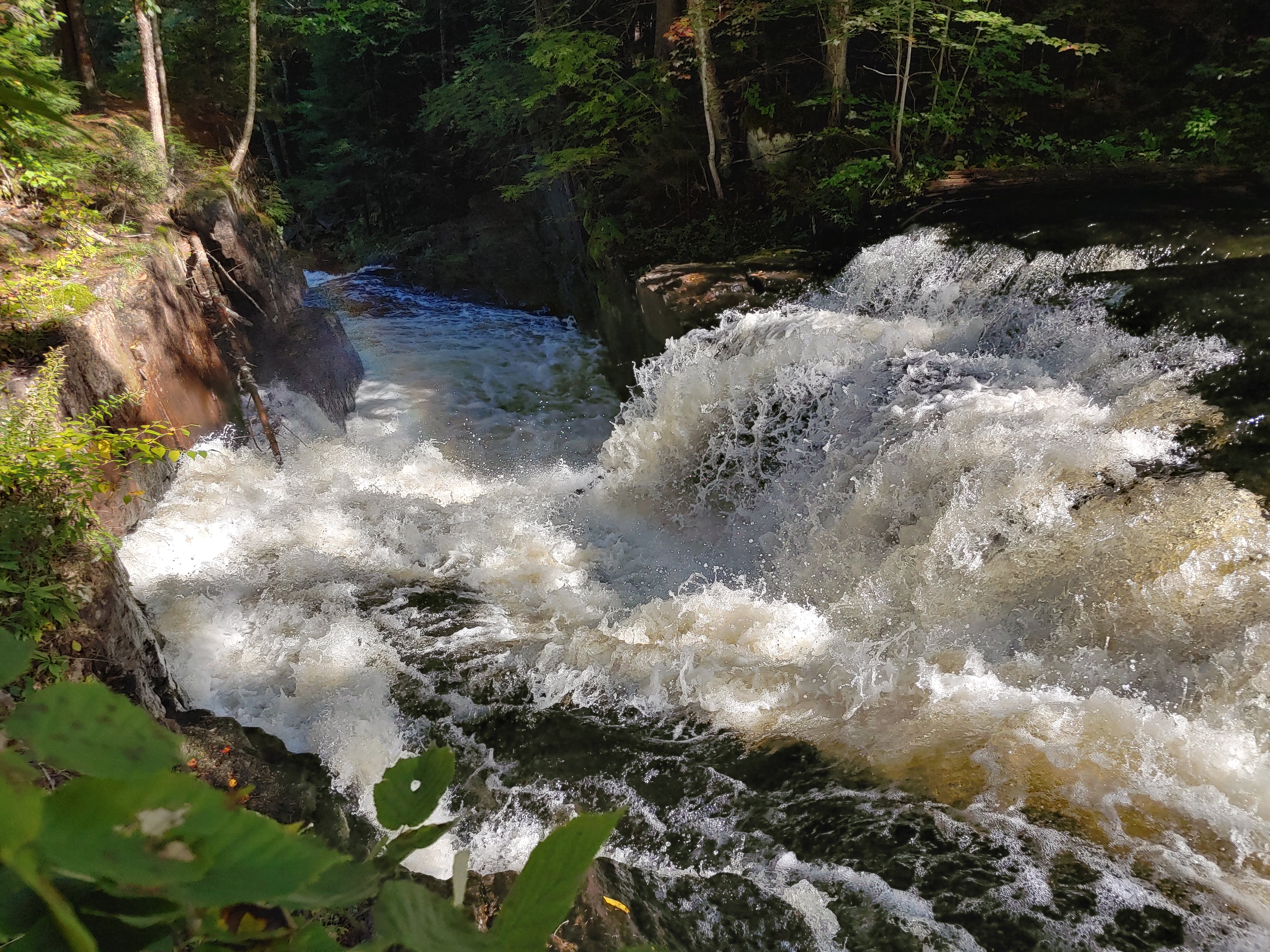
When we got to the falls we were quite impressed.  There really three seperate significant drops, as seen in the pictures below. 


Marker near the falls


The water really roars through the area.  It must be something to see in the spring.


Yes, it is winding

The falls exceeded our expectations, making this hike defintely worthwhile in our minds.


No swimming here..


Perhaps you could swim below this last portion of the falls 

It took us an hour each way at a moderate pace.  We lingering at the falls for awhile since it was so nice.


Rev is hiding...

We had brought our tent and camping gear in case we decided to spend the night up north.  After returning to the car we headed south towards Indian Lake.  We arrived at the Lewey Lake State Campground on the SW corner of the lake and found, or our surprise, that one of the prime lakeside sites was empty.  We inquired at the campground office and the attendant said "yep they left a day early".  Perhaps they hadn't been prepared for nighttime temps of about 40 degrees, but it was our good fortune.  We snagged the site and had a lovely evening campfire lakeside.  We awoke to the predawn glow pictured below.   All in all a nice trip!    

Pre-sunise at Indian Lake

 
The route

Hike Stats:
Hike Distance:  5.5 miles
Total Vertical Gain:  650'
Hike Time:  3 hours, including stops 

Saturday, August 14, 2021

Indian Lake Paddle to Dug Mountain Brook Falls - 8/13/2021


Indian lake boasts a nice DEC State Boat Launch on the spit of land between Lewey Lake and Indian Lake in Sabael (GPS Coordinates 43.652017, -74.387589).  Boats large and small can launch there.  A large parking lot makes parking a breeze.  Canoe rentals are also available (in season).  There is an $8 day use fee for parking during the summer months.

This launch site was my jumping off point for a long day paddle to see Dug Mountain Brook Falls.  It was roughly 8.3 miles each way, plus a .25 mile hike each way to see the upper falls.  Prior to the paddle adventure, I took my dog Rev for a morning walk before the extreme heat and humidity of the day, then I left her to take a nap in the cool cellar.

It was noon when I finally got myself on the water.  It was about 85 degrees and with the excessive humidity it felt almost tropical inland, but not on the water!  


Sign on Route 30 at the boat launch entrance


Snowy Mountain to the West

There was a nice breeze on the water which kept me from sweating profusely.  Plus I came prepared to swim and swim I did.  Indian Lake has almost unlimited inviting landing points with sandy beaches where it is easy to land jump into the water.

For those that are interested in camping, the New York State Department of Environmental Conservation runs the Indian Lake Islands CampgroundReserve America handles the reservations.  There are 55 sites, and all the sites I've seen are awesome.  It's hard to go wrong with a site on Indian Lake.  Some of the sites are on islands and some are on the shoreline, but all are exceptionally nice and very private.


My 1st stopping point for a swim


Another swimming break spot

After about 2-1/2 hours of paddling and swimming I entered the Jessup River and found the location where the Dug Mountain Brook spills into the Jessup.  There is a picnic area sign there and a spot with a fire ring and a picnic table.  The lower falls is visible from the Jessup.  


Lower Dug Mountain Brook Falls

To get to the upper falls, you have beach the boat and take a short .25 mile hike.  I was ready to take a break from paddling and stretch my legs.  I followed a herd path on the north (left side) of the brook and made my way upstream.    There are a couple blowdown trees to climb over, but nothing too bad.  I reached the upper falls in a matter of minutes.


Upper Dug Mountain Brook Falls

Of course I went for a swim here at the upper falls also.  I thought the water might be a bit colder than the lake but it wasn't bad.  Usually the mountain stream are quite cold, even in August.  There was a little spot in the basin of the falls where the water depth was over my head, but I got right in and got under the falls.  Mission accomplished!  Another great waterfall swim.
 

Some cools afternoon clouds passed through between 3 and 4 PM.

It was just about 3 PM when I left Dug Mountain Brook Falls to replace my route back to the boat launch.  There was a chance of an afternoon thunderstorm, but while a few clouds rolled through, no rain developed. 


I kept up a steady pace got back to the north end of John Mack Bay in just over an hour.  The sun was back out, so I nosed around the southern end of Long Island for a bit before paddling the final 2.3 miles back to the launch.


Nobody was on site 33 yet, so I stopped there for a snack.


That is a large stump!


The south end of Long Island


My arms suddenly got tired in the last mile of the paddle.  I hadn't paddled this distance yet this year so it felt good, but I was suddenly tired.


Heading back to the launch

On the way home, an extra thick milkshake from Stewart's in Indian Lake hit the spot just right.  On my next adventure to Indian Lake I'll explore John Mack Bay and some of the islands to the NWE of Long Island, but that will be another trip....


The route


 Paddle Stats:

Paddle Distance: 16.8 miles
Hike Distance:  0.5 miles
Trip Time (including stops) - 5 hours

Sunday, January 10, 2021

Mount Cardigan , Orange, NH - 1/9/21

 If you haven't been to Mount Cardigan State Park, Mount Cardigan State Forest, the Appalachian  Mountain Club's 1200 acre Cardigan Preserve or AMC Cardigan Lodge, consider taking a look.  Mount Cardigan is worth visiting in any season.  Lots of great hiking trails, open summits, backcountry ski trails, camping options and lodging options.  The area is conveniently located between I-91 and Lake Winnipesaukee in New Hampshire.  It truly is an area with something for everyone.

My goal for this hike was for my wife and I to meet up with my daughter and one of my son's to do a loop hike that would include the summit of Cardigan.  I chose to start from the west side of Cardigan by parking at the winter parking lot (on Burnt Hill Road) for the West Ridge Trail.   With the gate to the summer parking lot closed, the hike is lengthened by a half mile or so each direction, but that gives you a chance to get your lungs going before the real climbing starts and a chance for a easy finish on the way out. 


Pavilion at the summer parking area.

From the summer parking lot, it is only 1.5 miles to the summit of Mount Cardigan via the West Ridge Trail, but that was going to be our descent route.


The sign at the start of the West Ridge Trail

  We went up the West Ridge trail for only a half mile before taking the right fork on the South Ridge towards Cardigan Rimrock to start our counter-clockwise loop.  The snow depth was probably only 4-6", but there were occasional drift areas we had to punch through.


The fork between the West Ridge Trail and the South Ridge Trail


Just prior to Cardigan Rimrock the first viewpoint opens up .


A first viewpont


Rimrock


Nick & Lindsay at Rimrock with Mount Cardigan in the background

From Rimrock, we took the Skyland Trail to Mount Gilman (Orange Mountain on my topo map).


Mount Cardigan from Mount Gilman


At Mount Gilman, we dropped down the Vistamount Trail down past the Clark Trail and the Cathedral Forest Trail to the Holt Trail, where we were greeted with the warning sign below.  With the gear we had on hand (microspikes), we decided to backtrack to Cathedral Forest Trail to begin our ascent back towards Mount Cardigan. 


The Cathedral Forest Trail connects to the Clark Trail from which we continued upwards towards the summit.  Our partly Skies were clearing into a full bluebird sky as we neared the summit.  The wind was strong though.


The old fire lookout cabin


Looking to South Summit and Mount Gilman


We took some time to add a layer and some face protection as we broke above the treeline.


A windblown summit cone


The view from the summit is awesome in good weather, and today was one of those days.


A look at the 1924 firetower on the summit.


Rev is hoping for a snack.


Looking north towards Firescrew Mountain from the summit of Mount Cardigan.


Starting to head down the West Ridge Rail

We enjoyed the sunny summit for awhile, in spite of the wind.  To complete our loop hike, we returned via the West Ridge Trail.  The trail was hardpack snow and with microspikes it was an easy return to the car in less than an hour. 


Rev the fearless leader


The crew - Lindsay, Leesa & Nick


An interesting pink ring in the sunset on the way home.


Everybody loved this peak and multiple hike (and ski) options that are possible here.  It was a good day that we'll remember.  We completed the day by picking up some pizzas on the way out.

Hike Stats:
Hike Distance:  8.5 miles
Hike Time:  5 hours, 45 minutes
Total Vertical Gain:  ~2800'


The route