Lake George

Lake George
Lake George - from Tongue Mtn Range - 11/11/2011

Sunday, September 27, 2015

The Pinnacle for Sunrise - Bolton Landing - 9/27/15

On this day, Leesa, our dog Rev and I, along with our friend Mark, chose to head up to the Pinnacle in Bolton Landing for sunrise.  This wonderful Lake George Land Conservancy property provides an outstanding view looking east to Lake George in exchange for a meer 15 minute hike and a climb of 450 vertical.  

We parked at the parking area on Edgecomb Road and started our climb at about 6:10 and reached the summit at 6:25. On this morning there was a long thin series of clouds laying just above the lake and drifting northward.  The clouds added some interest to the panorama without blocking the view of the lake.

It was chilly (38 degrees) and a light breeze was blowing as we all stood there in amazement clicking away with our cameras.  The cool weather didn't bother me as I snapped over 200 pictures in about 15 minutes.    

I'll let the sample of pictures below speak for themselves. 


Sunshine!


As we were making our way down, I noticed a new yellow marked trail heading north from near the summit.  A laminated piece of paper indicated that it lead 1.3 miles to Edgecomb Pond.   I came back later in the day to  follow the trail.

I first went back to the summit of Pinnacle, then took the yellow trail north.  It continued north almost until Finkle Road, then turn west, reclimbing all the elevation that it had lost, until it emerged on Edgecomb Road, about a quarter mile north of the trail to Edgewood Rond (and the red trail to Cat Mountain).   The trail is marked the entire way with yellow LGLC markers, but it has not received any foot traffic yet so care is needed to follow the markers.

Once out to Edgecomb Road, I walked the 0.8 miles on the road back to the Pinnacle parking area.

To finish the day, Leesa and I went for a kayak paddle on Glen Lake.


The early afternoon view from the Pinnacle. 


The Pinnacle (Red) trail and the Yellow Trail (shown in blue)

Monday, September 21, 2015

Raquette River, Pickerel Pond, Rock Pond, Moose Pond and Franklin Falls Pond - 9/20/15

After having spent a fun but rainy night in our tent at a fantastic campsite in Coreys on Stony Creek Ponds we wee up and out early to clearing skies.  The cold front had come in and the weather was noticably cooler than it had been on Saturday.

Leesa had a morning campfire to take the chill off and I jumped in the kayak to take a morning paddle. I went around Stony Creek Ponds and a little ways down Stony Creek towards the Raquette River and Axton Landing before heading back to our campsite.  On my way back I spotted a bald eagle... probably the same one I had seen the before.  I carefully paddled closer and pulled out my camera and was able to snap a couple of nice shots.  In looking at the picture, I think I can even see a band on the foot of the eagle.


Bald eagle at Stony Creek Ponds

After watching the eagle, I returned to the campsite and we got ourselves together for some more hiking and exploration.  We left the tent set up to dry out in the sun.

Our first stop was Axton Landing.  We drove the short distance to the boat launch there, then hiked around to campsite 12, just downstream.   


Rev ... exploring on her own

Next we drove further on Coreys Road to an unmarked turnoff on the right.  This leads to a cable crossing on the river that supports a small tram car that takes property owners to a hunting camp on the far side of the river.  I'd like to see it in operation.  

Just upstream from the cable crossing is another campsite.  This one has a nice little beach.  There was no "camp here" disc so this one may not be legal.  If not, it still receives obvious use.


Campsite just upstream from the cable crossing.


The beach at the campsite.


The outlet of Stony Creek into the Raquette River

We returned to the car and continued down Coreys Road.  I wanted to note the locations of all the campsites on the road.  There are many.

We got to the Seward parking area and it was time to turn around.  The Seward lot wasn't full, but there were perhaps a dozen cars there plus several trucks with horse trailers.  I also noticed an old hay wagon near the trail kiosk that wasn't there last time I had been there.

We turned the car around and stared out.  Our next stop was the jeep trail on the right at Ampersand Brook.  This one leads to a pair of campsites; the 2nd one being the best at located at the waters edge.      

Ampersand Brook


Rev at Ampersand Brook
Continuing back on Coreys Road, there are a pair of small ponds on the south side of the road that have marked trails leading to them.  We stopped at the first one, Pickeral Pond, and took the short trail to it.  There was a rowboat at the shoreline, but no oars.  We saw a pair of hunters on this trail, wearing camoflage and doing some scouting. 


Pickerel Pond


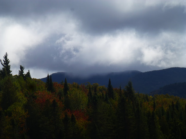
Looking towards the Sewards from Pickerel Pond

We returned to te car and drove over to the trail for Rock Pond.  This was another short trail.  Both trails were less than a half mile long.  At Rock Pond, there was a row boat once again, and a conoe as well.  The canoe was a metal canoe with a pair of oars and it looked sturdy.

Leesa wanted to go for a paddle, so she, Rev, and I piled in and I paddled us around the circumference of the pond.  Rev did very well in sitting nicely and not walking around the canoe.     


Rock Pond

Back on shore, we returned to Coreys Road and made our way back to our campsite.  It was time to pack up our gear and free up the campsite for someone else.  I tossed the sleeping pads out onto the ground and Rev sat down on them looking as if she couldn't believe we were leaving.


What a sight.  Did Rev want to camp again?

We left Coreys and next headed past Saranac Lake and north past Bloomingdale to Moose Pond and the boat launch there.  We had XC skied to Moose Pond from Route 3 in the winter, but we had not seen the pond in the summer.  There is a peninsula at the northern end of the island that offers a fantastic campsite and a rock outcrop at the point from which you can see sunrise and sunset.  

There are also may campsites along the east shore of the lake including one at the NW end of the lake with a large rock outcrop to enjoy sunrise.
    

Moose Pond looking south.


Rev at the campsite on the peninsula. 


Moose Island peninsula


The north end of the pond.


Looking at the peninsula campsite from the west shore.

We were surprised that there was only one car at the big boat launch area when we arrived. Three cars of fisherman showed up later, but the pond was still eerily quiet for such a nice day.

Our last stop for the day was Franklin Falls Pond.  We stopped at the designated campsite on the NW shore (there is actually a pair of sites there, but the nicest site is the one by the waters edge.  It's an extra large level site in the pines overlooking the water.

Just to the east of the campsite is a state boatlaunch and I dropped a kayak in the water for quick paddle.  I went out to an island that was visible from the boat launch.. There were 2 islands there. The larger one has a great beach as the west end.  Camping is prohibited on these islands, but they are a nice place to visit.    


Island on Franklin Falls Pond.


A short pause for island exploration.


And another.


All good paddles come to an end and after a quick tour of a portion of the pond it was time to admit we had to head home.  Today we made a lot of little stops but we saw some great places and gained ideas for future trips.


Sunday, September 20, 2015

Raquette Falls - High Peaks Wilderness - 9/19/15


Weekend goals:  Camping on waterfront, hiking, kayaking, swimming.

It was a tall order.  I gave it some thought last week and came up with Coreys and the Raquette River. Coreys is a hamlet located just south of Route 3, between Tupper Lake and Saranac Lake.  It is just south of Upper Saranac Lake.  Coreys is well known to locals, and to aspiring 46ers, who use Coreys Road to access the Seward Range.  Boaters use Coreys Road as well to launch into Stony Creek Ponds or the Raquette River.  We were fortunate to have my son Zack (and dog Lulu) join us after a last minute invitation on my part.  

I was hopeful that we would be able to camp at the designated site on Stony Creek Ponds that is accessed from Coreys Road.  it is on a point that is surrounded by water on 3 sides.  It is a nice level site in the pines and has a nice private sandy beach!  It is the first site on the left as you head down Coreys Road.  There is a short path to access the site, but it is not marked at the road.  You can see the location of the site on the map at the bottom of this post.

We arrived at Coreys at about 10:30 on Saturday morning and the site was available!  We quickly set up our tent and left some gear there before continuing south on Coreys Road to the Stony Creek Parking Area. Our hike was going to be the trail to Raquette Falls.  This is a designated horse trail and there were 3 trucks in the parking lot with horse trailers.


Signage at the parking area.


I love these old hand pumps.  This one is in the parking area.

Our first stop was the Stony Creek lean-to.  This lean-to is only a 5 minute walk from the parking lot and it lies in a beautiful location tucked just above the Raquette River with a wonderful beach at the water's edge.  Nobody was there!  Simply amazing that it was empty.  I guess mid-September is the reason, although I find this weather to be better than summer.

The dogs spent some time on the beach and in the water.  Rev won't swim, but Lulu loves the water. Below are a few pictures of the dogs for Zack.


Halfway to Raquette Falls, there is a fork in the trail.  The left fork heads away from the river and towards Calkins Brook.  We took the right fork to continue to the falls.  We passed the Hemlock Hill lean-to and it was occupied so we didn't go over to it.


The fork in the trail at the 2.2 mile mark. 


Interesting mushroom.


An old tractor that remains near the Interior Outpost.

Just prior to the DEC Interior Outpost, the trail reaches rapids at a beautiful spot on the river.  There are large boulders and a beach to add to the scenery.


The start of the rapids. 


After 4.3 miles, we came to the DEC Interior Outpost, a nice ranger facility.  Just beyond the outpost are the series of falls.  The water is still relatively warm and we saw several guys swimming at the falls.


The Interior Outpost at Raquette Falls


At the upstream end of the falls is a large danger sign warning boaters about the falls ahead.  There is a nice beach there for boats to land.  A nice carry trail is available for boaters to use to bypass the falls.
  

Leave the river here!


Zack and Lulu at the start of the carry trail.


We turned around at the start of the carry trail and headed back.  We didn't see any hikers (or horses), but there were quite a few boaters on the river.

Just as we got back to the car, it was starting to rain.  We said a quick goodbye to Zack, and headed back to our campsite.  We had left our gear (including sleeping bags) in the tent without the rainfly on.  We managed to get back and get the fly on before anything got wet.

The rain started and stopped several times.  It seemed that each time I would try to start a campfire, it would start to rain.  We gave up and went in the tent to read.  At 8 PM or so the rain stopped and we went out and had our campfire.  When our bundle of wood was gone, we turned in for the night.  

It was very windy, and just before midnight heavy rains came in.  Our tent was located in a good spot and no water seeped into the floor of our tent.  The rainfly kept the rain out from above and all was good.  The dog even slept!


Our campsite for the night.

Hike Stats: 
Hike Distance:  11 miles
Hike Time:  5 hours, including stops
Total Vertical Gain:  ~ 800' 


The hike route


The route of a short paddle on Stony Creek Pond.