
In honor of Hurricane Sandy, I took a pre-hurricane hike to Hurricane Mountain in the Hurricane Mountain Wilderness Area. I had last hiked this mountain on 6/20/10 (Father's Day) with the family. On that trip we hiked the mountain from the trailhead on Route 9N. On this trip, I took the trail from the east off of Hurricane Road.
 |
| Trailhead sign |
This trail starts with an easy private road access walk on a jeep road, gaining only about 550' in 1.2 miles. After that, the road ends and the marked trail climbs 1200' in 1 mile to the rocky summit. Trail conditions were good on this day. It was warm (about 63 degrees).
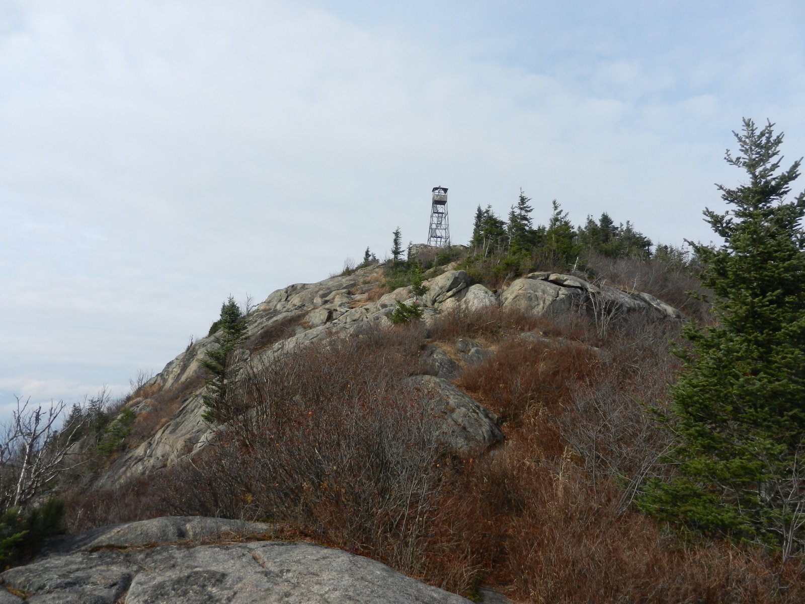 |
| First view of the summit |
When I went past the Route 9N trailhead, I noticed 10 cars in the parking area, 9 with Quebec plates and 1 from NY. I figured I'd run into a crowd on the summit. There was only 1 car parked at the Hurricane Road trailhead, and I shortly ran into a man with a dog leaving.
 |
| Clouds blowing through |
I didn't see anyone else until the summit, where a group of 30 Canadians were enjoying lunch on the summit. They must have been part of a hiking group or something to have that many people together. I reached the summit after an hours and 20 minutes.

At the top it was breezy but warm. Clouds were blowing through and at times visibility was good. I stopped for lunch and gave the dog some treats and we headed back down. It took about an hour and 10 minutes on the way back.

We were back to the car at 1:15 PM and headed south on Route 73.


 |
| My route shown in blue (click image to enlarge) |
Hurricane Mountain Hike Stats:
Hike Distance: 4 miles
Hike Time: 2.5 hours
Total Vertical Gain: 1825'
Trailhead Elevation: 1900'
Summit Elevation: 3694'
Hike Part 2
We decided to do a little more exploring since it was still early and we pulled into a jeep trail on the west side of Route 73 where it crosses the North Fork Boquet River (just south of the Round Pond Trailhead).
.
 |
| North Fork Boquet River - Spotted Mountain in the background |
There is a nice designated campsite just in from the road on the jeep trail. From there, a herd path follows the southern side of the North Fork Boquet River in a southwesterly direction. Several more designated campsites were passed along the way.
 |
| Nice pebbly beach areas along the river |
 |
| Rev is in the water enjoying herself |
After 1.7 miles, I reached LilyPad Pond with good views of the Dix Range in the background. It was time to turn around for the day. On a future hike, I'll continue in on a bushwhack hike to climb Spotted Mountain. It's a mountain with lots of rock on the summit and great views. For now, I was happy to do some surveillance of the area and see Spotted Mountain from a distance.
 |
| LilyPad Pond with Spotted Mountain and the Dix Range in the background |

 |
| Back at camp, a grouse was waiting to have its picture taken |
LilyPad Pond Hike Stats:
Hike Distance: 3.4 miles
Hike Time: 2 hours
Total Vertical Gain: 500'
 |
| My approximate route (Click image to enlarge) |
No comments:
Post a Comment