It was time to get out for my first bushwhack hike of the season. I had heard good things about Owl Pate and Bald Pate in the Hammond Pond Wild Forest, just south of Moose Mountain Pond. It was a good fit for my Friday, since I was getting a late 10:15 start.
My route was to hike from the trailhead at Ensign Pond Road, off of Route 9, near Exit 29 of I-87, to Moose Mountain Pond and then bushwhack from there. The trail portion of the hike was 3.2 miles to the pond. I arrived there at 11:30. I was disapointed to find some litter at the leanto at the pond. There was a bag of garbage and 2 full water bottles in the fire ring, some pine boughs in the leanto and a pair of camouflage pants and sweat pants, along with some greasy pans and newspaper. This was my 2nd time past this leanto, and both times there was garbage here. It's too bad because it is a nice spot. I packed out some of the garbage.
 |
| A brand new register box, one week old. It still smells like new paint |
On the way to the leanto, trail conditions were a mix of ice, snow and bare ground.
 |
| A waterfall along the Berrymill Brook |
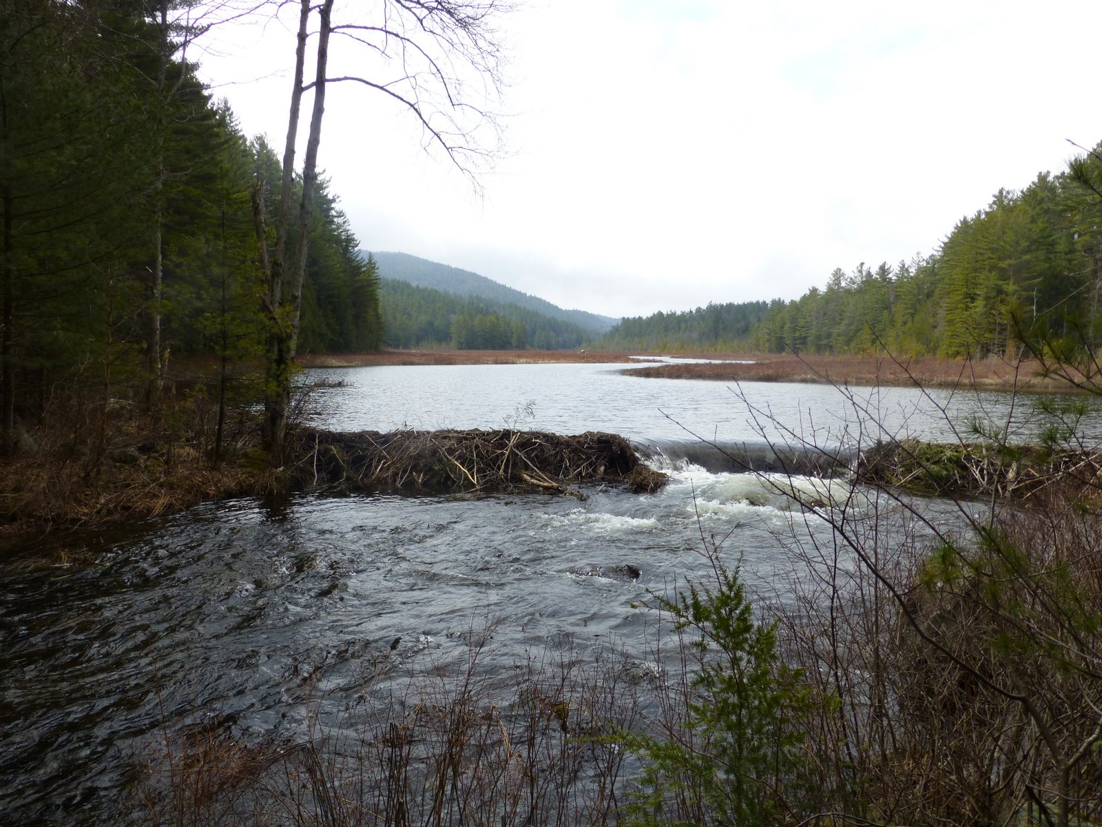
 |
| Berrymill Pond outlet |
 |
| Some ice flows are still around down low. 18" of snow up on the ridge |
 |
Moose Mountain Pond Leanto
 |
In the distance on the picture below is the Bald Pate - Owl Pate ridge line which was my destination for the day. After enjoying Moose Mountain Pond, I went back to the outlet and crossed over to begin my ascent to the ridge. As I made my way up to Bald Pate I reached the snow line about halfway up at around 1700'. There was about 18" of snow on the north facing slopes of the ridge.
 |
| Bald Pate on the left, Owl Pate on the right from Moose Mountain Pond |
 |
| Moose Mountain Pond from a nice ledge just north of the leanto |
 |
| Near the outlet of Moose Mountain Pond |
I had expected the ridge to be fairly open, and an easy bushwhack, but I encounter some fairly thick pines and lots of blowdown. It took longer than expected to reach the ridge. Both the Bald Pate and Owl Pate actual summits are in the trees, but both have viewpoints from south facing ledges. Schroon Lake can be seen in the distance to the southwest.
 |
| Owl Pate from Bald Pate |
It took about 40 minutes to go from Bald Pate to Owl Pate. The ridge was a mix of hardwoods and softwoods. The softwoods were not pleasant to work my way through, due to the blowdown and the deep soft snow that was still around.
 |
| View from Bald Pate |
I had expected the summits to be a little better than I found them to be. Don't get me wrong, any day in the woods is a good day, but I guess the talk I had heard about these summits led me to expect more.
 |
| View from Owl Pate. Schroon Lake in the distance |
On my way down from Owl Pate, I headed headed pretty much north-northeast at about 20 degrees on my compass. The north slope was open hardwoods, but the deep soft snow made the descent tough. I was soaked right through.
The temperature was warm. It was 55 degrees at the start, and 65 at the finish. I was back at the car at about 4 PM.
 |
| Approximate Route |
 |
| My route (Click image to enlarge) |


Is there an additional designated campsite other than the lean to one?
ReplyDeleteThere usually is but I don't recall at this location.
Delete