Lake George

Lake George
Lake George - from Tongue Mtn Range - 11/11/2011

Monday, August 31, 2015

Shanty Brook and Kibby Pond - Siamese Ponds Wilderness - 8/30/15

The Siamese Ponds Wilderness is quiet in terms of visitor traffic and that is a nice feature.  It also offers many hidden gems which help to double the fun.  Leesa and I visited a few gems today.  Our first stop was the Shanty Brook Trail.  This is a herd path that goes to Mud Ponds, but that wasn't our goal.  We wanted to climb an un-named open rock hill that lies just west of the beginning of the trail.

There is a parking lot on the east side of Route 8, but there is also enough room to park on the west side, which is what we did. You can also drive in the jeep road a couple hundred yards to an attractive campsite near the water.  The jeep road ends just after the campsite.

There used to be a cableway to use to cross the Sacandaga River for the Shanty Brook Trail, but it is no longer there.  Water levels were low so we simply waded across the ankle deep river using our water shoes.


The Sacandaga River


Site where the cable used to go over the river.

Once across, we followed the Shanty Brook Trail until it turned northward.  This was our jumping off point to begin our short bushwhack.  Google Earth showed a horseshoe shaped summit of open rock. Our climb of the eastern slope was steep, but open and short.  We climbed about 600 feet in 0.4 miles through mostly beech trees.

The summit did not disappoint.  We explored the eastern half of the horseshoe first, followed by the west side.  It became obvious to us that this is a rock climber's location.  There were various foot paths in the area and we saw some rock hardware attached to some of the vertical surfaces.  We also could hear some voices down below but we never did see anyone.       


The eastern summit. 


One of several fire rings near the top.


Can you see the climbing hardware in the rock?

Now you can...


This is all part of the eastern end of the horseshoe.

It was fun to explore all the nooks and crannies of the different rock faces.


Rev was hot.  I carried a lot of water for her and she drank quite a bit.

 When we were done, we returned to the Shanty Brook Trail (unmarked herd path), and followed it for about a half mile to see what it looked like.  We came to a for side path on the right which led to the waterfall below.  This was only about 3/4 mile from the road.  It had quited a bit of water flowing over it considering the lack of rain recently.   


Nice!


We spent some time here and went for a swim.  It would be interesting to see what this looks like in the spring, or after a period of heavy rain.


Next we went back to Route 8,crossed over to the east side of the highway and took the trail to Kibby Pond.  The trail only had two trail markers on it that I saw, but it was flagged with orange ribbon (which was needed in spots since the trail was quite overgrown in spots).

This trail didn't do anything to impress us.  It ended at an illegal campsite at the water's edge, complete with a smashed up rowboat.  The pond itself was good size and might have been nice for a paddle, but we didn't go out on the water.
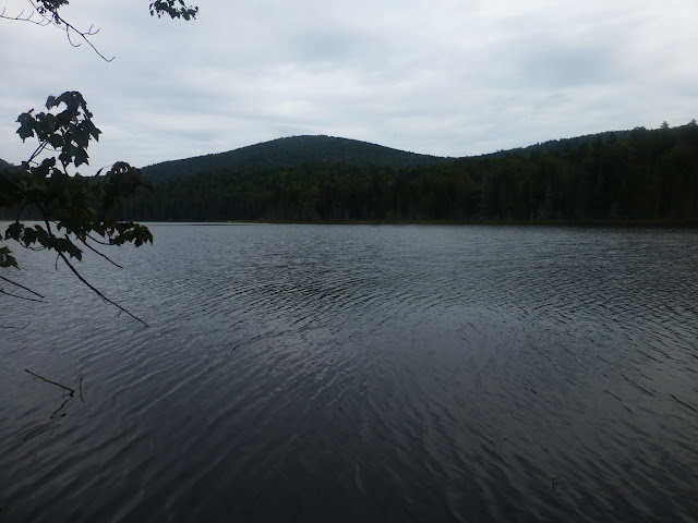


Kibby Pond


Our last adventure for the day was a short walk on the East Branch Gorge Trail in the same vicinity. We had been here before and remembered the great watering holes.  We chose the one at the cableway about a half mile in from Route 8.  The water was actually not cold but comfortable for swimming.  We took adavantage and went for a swim.  A good way to end the day.


Rev wasn't so ssure.


Potholes in the rock.


The  cable crossing.

The horseshoe hike and the waterfall.  The cable xing in no longer there.


The trail to Kibby Pond and the East Branc Gorge trail 


Hike Stats:
Combined Hike Distance: 7.2 miles
Hike Time:  5 hours (including stops)
Total Vertical Gain:  ~ 1800' 


Saturday, August 29, 2015

Stewart Mountain (3602') - Sentinel Range Wilderness - 8/29/15

Today I took on Stewart Mountain (3602') in the Sentinel Range Wilderness with my dog Rev.  It's another peak on the ADK Hundred Highest list.  It's not a long hike, but it's rugged and it's not a mountain that you set a good pace on.

I was on the trail around 9:30.  I parked at the small pulloff immediately west of the entrance to Whiteface Mountain Ski area on Route 86.

Almost immediately I saw my only small waterfall of the day.  I crossed the brook here and climbed on the left side of the brook to the height of land where I came to an old woods road.  
    

This is almost within sight of the car.

I followed the old woods road a short distance until it ended.  I continued to head almost directly south, picking my way along the easiest route I could find.  After about 45 minutes and one mile, I was at th base of Stewart.  This next section was the steepest, thickest part of the hike.  For about 0.5 miles it was slow going.  I was hoping it would not be that way all the way to the summit.  Luck was with me.  The grade eased and so did the tree density.  It still wasn't easy but it was better.    


A first look at Stewart Mountain

About 0.4 miles from the top I came across an interesting rock formation that had rock walled cavity that could be walked through.


The unnamed summit north of Stewart

I began to get views of Whiteface Mountain (which was the only view I could find).


Whiteface Mountain and Ski Area.


 I made my way slow and methodically as I continued to climb.  There were lots of rotted trees covered in moss and I found several spots where I fell in up to my thigh.

After 3 hours of slow climbing I found the true summit.  There was a tree with a small section of bark scraped off and a letter S caved in it for Stewart.   Not a big reward for the climb but it was a nice day to be out in the woods.  Temps were in the upper 40's when I started and about 70 when I got back to the car.


The summit indicator.

The summit.

Rev and I had lunch on the summit and then Rev led the way down following our route by scent. Very nice!  The only views continued to be of Whiteface but that was OK.  Going down proved to be a little easier and we cut 30 minutes of of our ascent time.  We got back to the car at 3 PM which was nice since we had a long ride home from Wilmington.


More views of Whiteface


Hike Stats:
Hike Distance:  4.4 miles
Hike Time: 5.5 hours
Total Vertical Gain:  ~ 2500'


The route (click image to enlarge)


Hermit Island Campground - Mid Coast Maine - 8/25/15

Monday we dropped my son Nick off at Logan Airport in Boston for his flight to Sweden.  He is spending the fall semester studying abroad.  Afterwards, Leesa and I continued on to Maine for a vacation.  We spent the first night at Ogunquit, then went to Small Point and Hermit Island Campground for 3 nights.  

Hermit Island is a kayaker's paradise.  There are also multiple beaches on the island and hiking trails as well.  I've camped here many times over the years.  My parents starting camping here when we were kids.

The first 2 days were mostly foggy with some rain, but the last 2 days were picture perfect.  Below is a photo summary.


A doe and fawn on the beach!


The blue trail, on the coast 


Leesa swimming


The kayak carry route


Popham Beach, looking towards Fox Island

Mike on Fox Island

  
On Fox Island, looking back to Popham Beach


On Fox Island


Dinner at Spinney's Seafood Restaurant


Goosberry Island - Presunrise 


Wood Island in the background


Another great cove and beach...


Our playground for the week